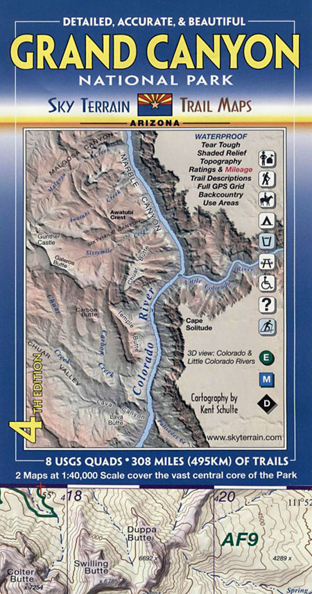
Grand Canyon National Park 1:40,000
4th Edition
Map Features
- Waterproof, Tear Tough material for years of hands on use.
- 32 trail descriptions, trail ratings, & trail statistics. 6 trail profiles. Over 308 miles (495km) of trails & routes.
- Full UTM grid with 2k spacing for ready use with GPS.
- Most up-to-date map for this area, including new trails & roads.
- Most accurate map for this area..
- Improved hydrological mapping. Symbology for springs, year-round & seasonal drinking water.
- Custom color tints reveal ground cover & create 3D effect.
- Shaded relief. 100ft contours.
- Geological Profile
- Backcountry Travel Zone boundaries and other important trip planning information.
- Covers 8 USGS 24K Quad maps.
Some well known points mapped include Bright Angel Trail, Cape Royal, Cape Solitude, Desert View, Grandview Point, Cape Final, Walhalla Plateau, Colorado River, Hermit Gorge, Tower of Ra, Shiva Temple, Point Sublime, North Rim, South Rim, Kaibab Trail, Tonto Trail, Grand Canyon Village, Yavapai Point, Mather Point, Phantom Ranch, Granite Gorge, Crystal Rapids, Silver Bridge, Hopi Wall, Zoroaster Temple and oh so much more.
Please note this map covers the core of the Park, the area where 99% of Park visitors travel, and where 90% of backcountry trips take place. Most trails and water sources are in this mapped area. The map shows 308,000 acres of huge country. It does not cover the far western or northern reaches of the Park.
|